Along the Pustertal valley Bikeway: from Olang to Bruneck

Add to favourites
Category
Difficulty
Easy
Duration
0:37
in hours
Distance
10.3
in km
NEW: MOVE calculates your personal route time for this tour.
Find out more about the project

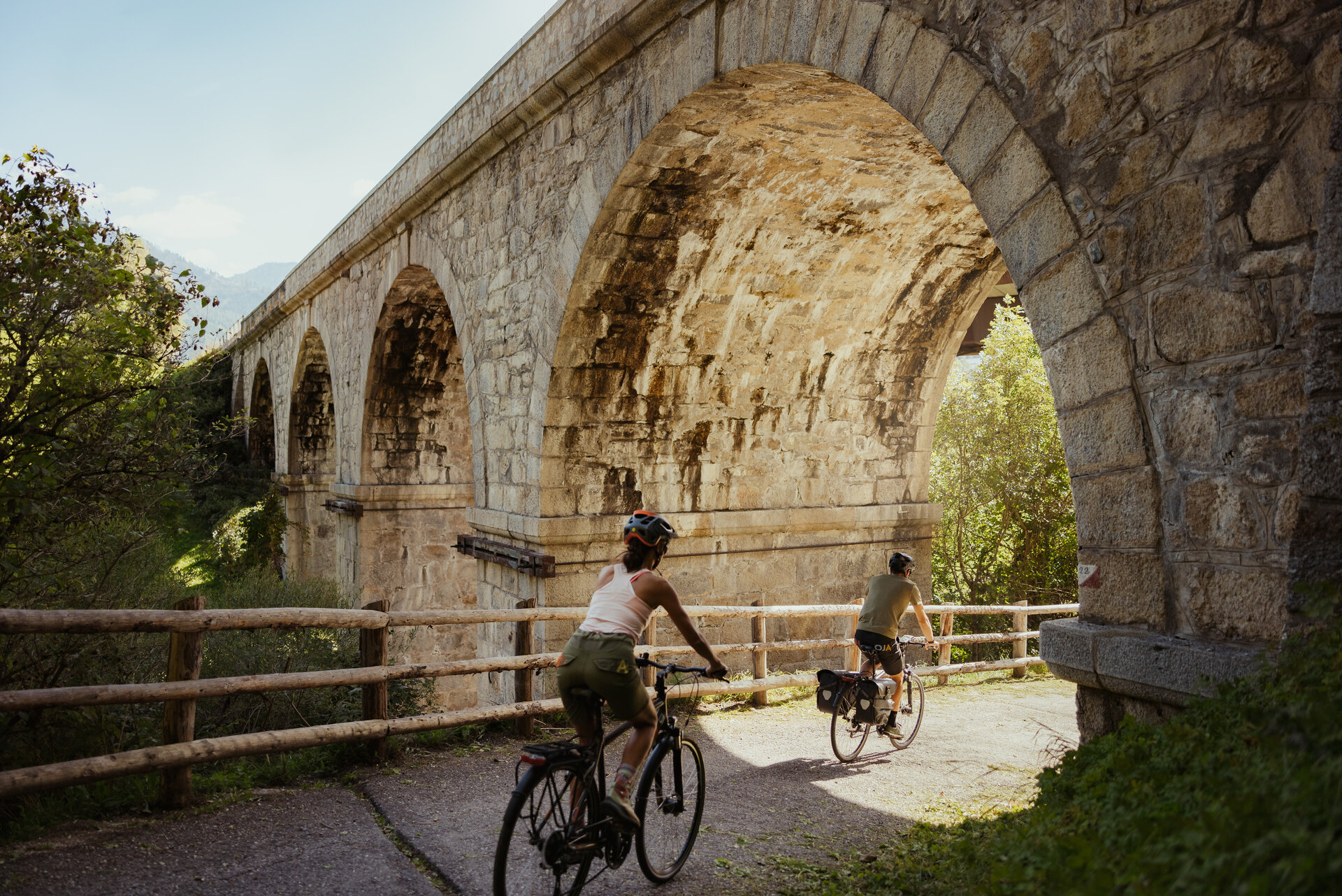
The starting point of this easy tour, which is suitable for all fitness levels, is the bus stop at the town hall in Mitterolang. From there, you follow Kerla Street to Niederolang and from there you continue along a paved road towards Percha. On the way there, the panoramic rest area near Litschbach right by the river invites you to take a short breather. The Pustertal Valley bike route then continues through dense forests and past the impressive Rienz Gorge towards Bruneck. Once you arrive there, it will be definitely worth exploring the old town of Bruneck with its numerous shops, cafés and restaurants.


For the return trip, simply take the train, which is free for Kronplatz Guest Pass holders.

Important: A separate ticket is required for your bike. You can get it at the ticket counter at the station or easily via the Südtirol Mobil Website.

Route data
Easy
Distance
10,3 km
Duration
37 min
Ascent
40 m
Decent
258 m
Highest point
1.048 m
Lowest point
827 m
You might be interested in
Discover related tours
Olang/Valdaora
Furkelpass / Passo Furcia
Distance 14,2 km
Duration 1 h 54 min
Ascent 832 m
Decent 101 m
Status
closed
MTB Tour Pitzinger Oberalm
Distance 5,1 km
Duration 1 h 35 min
Ascent 576 m
Decent 6 m
Olang/Valdaora
Around the Kronplatz
Distance 48,0 km
Duration 4 h 20 min
Ascent 1.309 m
Decent 1.301 m
Status
closed
Lake Dobbiaco | © TV Antholzertal, Tourismusverein Antholzertal
Intermediate
Add to favourites
Olang/Valdaora
To the Lake Toblach
Distance 22,4 km
Duration 1 h 43 min
Ascent 385 m
Decent 141 m
Status
closed
Olang/Valdaora
To Niederolang and Mitterolang
Distance 12,3 km
Duration 54 min
Ascent 172 m
Decent 232 m
Status
closed
Innichen | © TV Antholzertal, Tourismusverein Antholzertal
Intermediate
Add to favourites
Olang/Valdaora
To Innichen
Distance 25,2 km
Duration 1 h 52 min
Ascent 342 m
Decent 184 m
Status
closed