Kronplatz - Gassl Trail Tour

Olang/Valdaora
Add to favourites
Category
Difficulty
Intermediate
Duration
2:41
in hours
Distance
27.5
in km
Status
closed

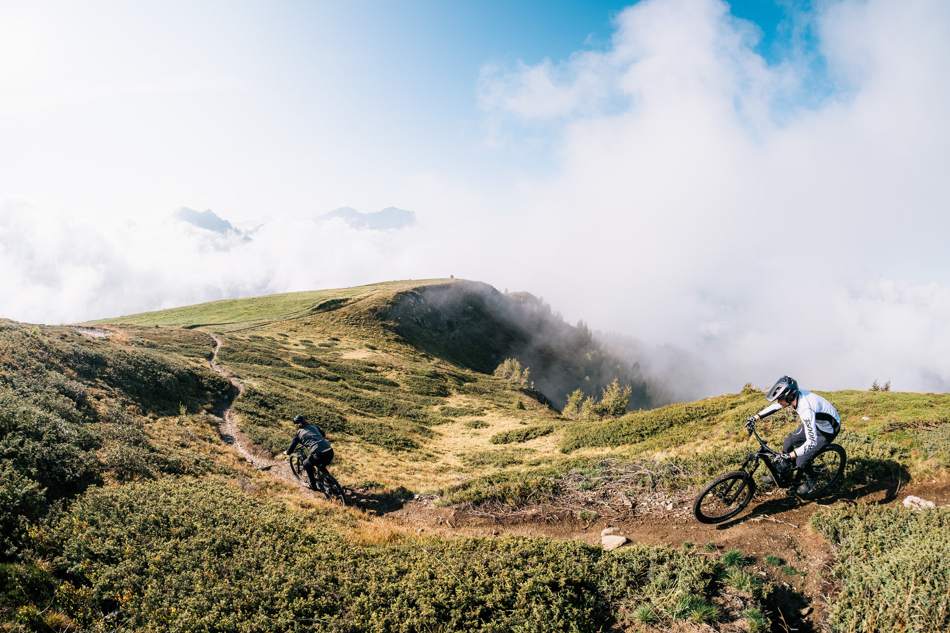
The summit plateau of Kronplatz in combination with the Gassl Trail makes this tour a must-do for all mountain bikers in good shape. We follow the Bad Bergfall Bogen tour from Olang to the Furkel street and then ride up to the top of the pass. From there it goes on gravel roads up to the summit plateau. 15 kilometers and 1,240 meters in altitude has this climb and this demands with steep sections of the bikers really a lot. At the top you will be rewarded with a great view towards the Dolomites. In addition, there are refreshment stops, two museums and also the Friendensglocke Concordia to marvel at. The real reward for the climb, however, lies in the following descent. The Gassl Trail is one of the flowier and easier trails at Kronplatz and leads over 8.6 kilometers down to Gassl near Olang. From there you roll gently downhill back to Olang.


Cultural highlights: Sulfur Spring, Lumen Museum, Messner Mountain Museum Corones, Concordia 2000

Route data
Intermediate
Distance
27,5 km
Duration
2 h 41 min
Ascent
1.238 m
Decent
1.238 m
Highest point
2.262 m
Lowest point
1.057 m
Olang/Valdaora
The Sulfur Spring
Other historical buildings
Bruneck and surroundings
Messner Mountain Museum Corones
Open
closed
Museums and exhibitions
Kronplatz
Concordia 2000
Open
closed
Viewpoints
You might be interested in
Discover related tours
Olang/Valdaora
MTB Skill Area
Distance 0,4 km
Duration 05 min
Ascent 19 m
Decent 20 m
Intermediate
Add to favourites
From Olang to the Lake Toblach
Distance 19,2 km
Duration 1 h 34 min
Ascent 300 m
Decent 87 m
Discover family highlights in Olang by bike
Distance 5,3 km
Duration 26 min
Ascent 70 m
Decent 80 m
Olang/Valdaora
Dragon Trail
Distance 2,0 km
Duration 08 min
Ascent 0 m
Decent 199 m
Status
closed
Pitzinger Alm mtb round trip
Distance 21,4 km
Duration 3 h 11 min
Ascent 933 m
Decent 933 m
Status
closed
Olang/Valdaora
Prags Lake
Distance 35,5 km
Duration 2 h 20 min
Ascent 708 m
Decent 708 m