Hühnerspiel

Olang/Valdaora
Add to favourites
Category
Difficulty
Difficult
Duration
4:51
in hours
Distance
45.6
in km
NEW: MOVE calculates your personal route time for this tour.
Find out more about the project

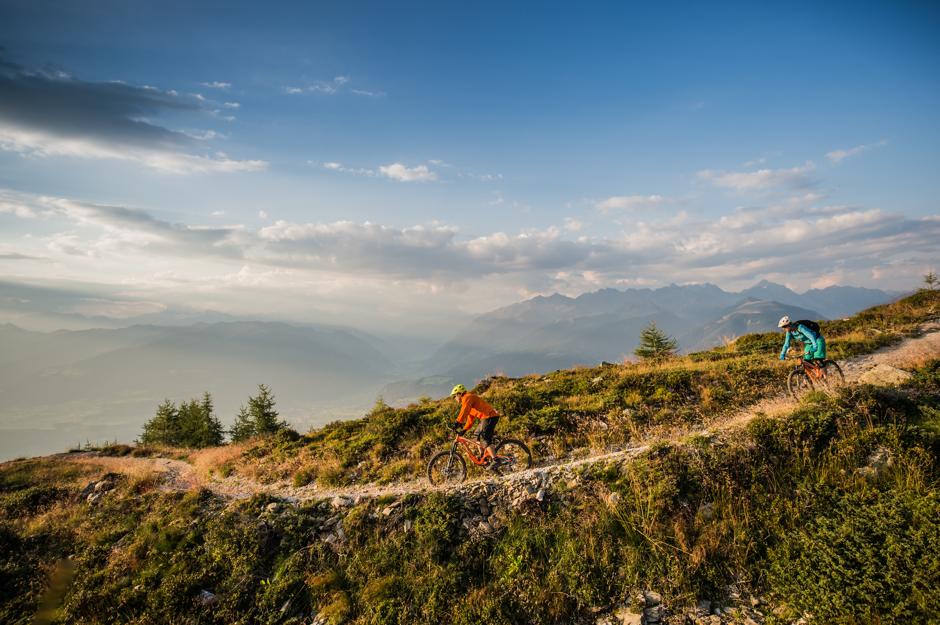
The tour to Hühnerspiel is a challenging loop with breathtaking views and awesome singletrails. The route starts in Olang and climbs past the earth pyramids up to the Lercher Alm. After a short refreshment break, you continue uphill into the valley toward the Haidacher Alm. Just before the end of the valley, the trail turns left onto a hiking path that leads up to the Hühnerspiel summit. At the top, you’re rewarded with incredible views of the surrounding mountains. What follows is pure downhill fun: the trail winds its way along narrow hiking paths into the Tauferer Ahrntal, specifically to the village of Gais. You’ll descend over 1,000 vertical metres, mostly on singletrails – a true highlight for any trail enthusiast. The return route takes you via Bruneck and the Pustertal cycle path back to Olang.


Potable Watersource: Fountain play ground, Niederolang

Route data
Difficult
Distance
45,6 km
Duration
4 h 51 min
Ascent
1.601 m
Decent
1.601 m
Highest point
2.187 m
Lowest point
825 m
You might be interested in
Discover related tours
Ein Mountainbiker auf einem Trail im Kronplatz Bike Park. | © Skirama Kronplatz
Intermediate
Add to favourites
Crazy Bunny Line
Distance 0,5 km
Duration 13 min
Ascent 1 m
Decent 489 m
Status
closed
Intermediate
Add to favourites
Olang/Valdaora
Bad Bergfall Tour
Distance 11,9 km
Duration 1 h 14 min
Ascent 428 m
Decent 428 m
Furkelpass | © Olang
Intermediate
Add to favourites
Olang/Valdaora
Passo Furcia/Furkelpass
Distance 11,8 km
Duration 2 h 02 min
Ascent 758 m
Decent 9 m
Status
closed
Olang/Valdaora
Variante Quota Passo / Variante Passhöhe
Distance 2,7 km
Duration 38 min
Ascent 207 m
Decent 17 m
Status
closed
By bike with the whole family to the playground in Welsberg
Distance 6,9 km
Duration 42 min
Ascent 126 m
Decent 85 m
Intermediate
Add to favourites
To the play paradise in Niederdorf
Distance 14,9 km
Duration 1 h 27 min
Ascent 218 m
Decent 94 m